Accurate site information is one of the most important foundations of any successful building or development project. Whether you are planning a new home, extension, subdivision or commercial development, a topographic land survey in Geelong provides the detailed site data needed to support informed design and planning decisions.
Topographic surveys are widely used by homeowners, architects, builders, developers and councils to understand the physical characteristics of a property before work begins. Without reliable survey information, projects can encounter design issues, approval delays and unexpected construction costs.
As Geelong continues to experience strong residential and commercial growth, accurate land surveying has become increasingly important for development and infrastructure planning.
What is a topographic land survey?
A topographic land survey, also known as a feature and level survey, records the natural and built features of a site along with ground levels and contours.
The survey creates an accurate representation of existing site conditions, allowing architects, designers, engineers and planners to prepare plans that respond correctly to the land.
Feature and level surveys in Geelong typically include:
- Land contours and elevations
- Existing buildings and structures
- Fences and retaining walls
- Driveways and access points
- Trees and vegetation
- Services and drainage infrastructure
- Kerbs, footpaths and surrounding streetscape details
- Boundary-related information
These surveys are commonly used for planning permits, architectural design, engineering works and property development projects.
Why topographic surveys are important
Every property has unique physical characteristics that can affect how land is developed. Sloping land, drainage conditions, neighbouring structures and existing services can all influence building design and construction requirements.
A site analysis survey in Geelong provides the accurate information needed to identify these conditions early in the project.
Topographic surveys help support:
- Planning permit applications
- Architectural and building design
- Subdivision projects
- Stormwater and drainage planning
- Construction site preparation
- Earthworks and excavation planning
- Flood and overlay assessments
By understanding site conditions from the beginning, project teams can reduce the risk of costly design changes and construction delays later in the process.
Understanding AHD level survey services in Geelong
An AHD level survey in Geelong connects site levels to the Australian Height Datum, which is the national reference system used to measure elevations across Australia.
AHD surveying services in Geelong are particularly important for properties affected by flood overlays, drainage controls or coastal planning requirements.
Land survey data connected to the Australian Height Datum helps councils, engineers and designers maintain consistency across planning, drainage and construction documentation. According to Land.Vic’s Vicmap Topographic Mapping information, topographic and elevation mapping is widely used across Victoria for infrastructure planning, land development and site analysis.
Using AHD reference points also helps ensure accuracy when assessing finished floor levels, stormwater flow and flood-related planning requirements.
How topographic surveys support planning and development
Architects, designers and town planners rely heavily on accurate topographic data when preparing development plans.
Feature and level surveys help ensure:
- Building designs respond appropriately to site slopes
- Finished floor levels meet council requirements
- Drainage systems function correctly
- Setbacks and building envelopes are accurate
- Existing site constraints are identified early
The City of Greater Geelong planning process requires accurate site and property information to support many planning and development applications, particularly where overlays, drainage conditions or land constraints may affect development outcomes.
Without accurate survey information, plans may need to be revised later in the process if site conditions differ from assumptions made during design.
Topographic surveys and construction efficiency
Accurate survey data can also improve construction efficiency by helping builders and engineers better understand the land before work begins.
Contour and level information can influence:
- Excavation requirements
- Retaining wall design
- Site access
- Foundation planning
- Stormwater management
- Material quantities
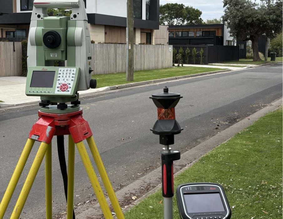
Surveying technologies including GPS systems, laser scanning and digital mapping tools are increasingly being used across the industry to capture highly detailed topographic information for development and infrastructure projects.
Topographic mapping and planning across Victoria
Topographic mapping is widely used throughout Victoria for urban planning, infrastructure design, environmental management and land development.
This demonstrates the broader importance of accurate topographic information in supporting development and land management decisions.
Choosing a licensed topographic land surveyor in Geelong
Because topographic surveys form the basis of important planning and design decisions, accuracy and experience are critical.
Working with an experienced licensed surveyor helps ensure survey information is reliable, compliant and suitable for planning, design and construction purposes.
Feature and level surveys can support residential, commercial and development projects throughout Geelong, the Surf Coast and surrounding areas by providing accurate site information for planning and construction teams.
Whether you require a site analysis survey in Geelong, contour survey data or AHD surveying services in Geelong, accurate site information can help support a smoother and more efficient project process.
Start your project with accurate survey information
Before beginning any design, planning or construction project, it is important to understand the physical characteristics of the land.
A professional topographic land survey in Geelong provides the detailed information needed to support informed planning decisions, improve project accuracy and reduce unexpected issues during development.
To discuss feature and level surveys, AHD level surveys or site analysis surveying services, contact Mark Potter Land Surveyor for professional advice and reliable survey solutions tailored to your project.